Microsoft Streets and Trips Alternative for 2025 - A Complete Guide [video included]

Every salesperson has their favorite sales tool to efficiently get the job done. But in a rapidly-evolving industry, tools often get replaced by the next generation of software.
Back in the day, everyone's favorite sales tool was Microsoft Streets and Trips. It was one of the most popular mapping softwares, used by thousands of salespeople.
Wonder what happened to it and what the best alternatives are now? Let's find out!
What is Microsoft Streets and Trips?
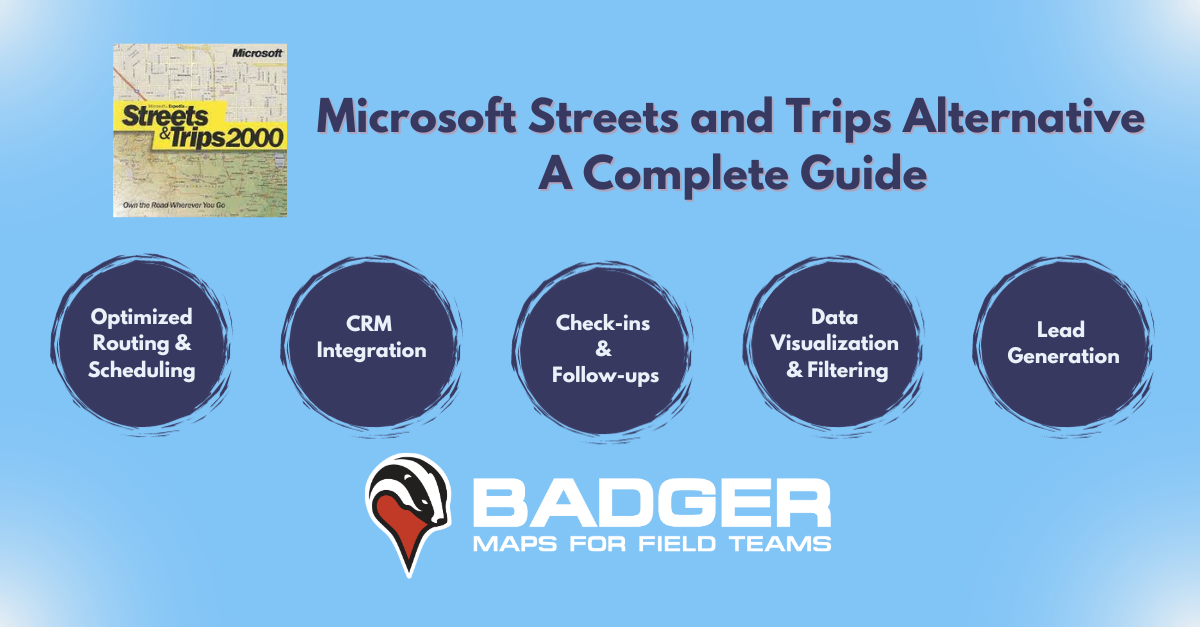
Released in 2000, Microsoft Streets and Trips was a mapping and routing software designed to build multi-stop routes.
It had six million miles of maps including details such as stores, restaurants, and gas stations. Its invention was a major milestone in the evolution of traveling resources.
Streets and Trips' users loved its route optimization options for multiple stops, which allowed them to choose their preferred route based on various criteria (freeway, scenic route, secondary roads, etc.). Plus, routes could be changed on the fly, with no need for Internet connection.
Streets and Trips showed relevant points of interest along the way. It also allowed users to add notes, phone numbers, and any other relevant information about their customers. These features were especially useful for field salespeople.
Yet despite its groundbreaking features and popularity, Streets and Trips had limitations. As you could only install it on PCs with a CD-ROM, Streets and Trips suffered from the technological restrictions of its time, such as a lack of updates.
It also was a time well before the era of mobile devices, when a lot of pre-planning was necessary for scheduling routes. As such, Streets and Trips lacked many of the on-the-go capabilities that today’s field sales industry demands.
Still, Microsoft Streets and Trips enjoyed tremendous popularity with salespeople. We had become dependent on its user-friendly interface and extensive maps to plan and optimize our daily sales routines.
Is Microsoft Streets and Trips still available?
Unfortunately, Microsoft Streets and Trips is no longer available for download. As the saying goes — all good things must come to an end.
Streets and Trips struggled to remain competitive in the rapidly-evolving digital mapping industry. Microsoft switched their focus to search engine Bing, with the hope that their mapping service Bing Maps could compete with the powerhouse of the industry, Google Maps.
Lost in the shuffle, Microsoft Streets and Trips 2013 was the last version available to the public, leaving many field salespeople without one of their most trusted resources for outside sales.
If the button above doesn't work, please update your cookies settings here.
How do I update Microsoft Streets and Trips?
Since it was discontinued, salespeople have wondered how they can update their favorite mapping software.
And it’s a good question — will Microsoft Streets and Trips work on their newer operating systems?
Even if you figure out a way to make Streets and Trips work on your current software, its download options are unavailable, making it impossible to update.
This left many outside sales professionals stranded, looking for the best Streets and Trips replacement.
What is the best Microsoft Streets and Trips alternative?
After Microsoft Streets and Trips and other popular software of the time such as Microsoft MapPoint were discontinued, it left many asking, what will replace Microsoft Streets and Trips?
The answer is Badger Maps, an app developed specifically with today’s field salespeople in mind.
Badger Maps is the best alternative to Microsoft Streets and Trips for outside sales. It’s user-friendly, easily customizable, and updated regularly with new features.
Badger Maps offers the advanced features that sales reps and managers loved in Microsoft Streets and Trips – things like routing, data visualization, check-ins, detailed follow-ups, and more.
The difference is that Badger Maps is optimized for modern-day selling, making it an invaluable tool for all field salespeople.
What makes Badger Maps the Best Alternative To Streets and Trips?
Created specifically for the outside sales community, Badger Maps allows for route optimization, customer check-ins, and a variety of other features to maximize time in the field.
One of Badger Maps greatest advantages is its user-friendliness, making it the best Microsoft Streets and Trips alternative. Badger Maps even offers new users free onboarding with Account Specialists who will walk you through the app’s features. You can quickly start optimizing your sales routes with unlimited stops and start increasing your sales.
The #1 route planner for field sales in all app stores, Badger Maps is designed to solve the main problems outside salespeople face in the field. From planning out their route to keeping track of check-ins in order to better manage their customer relationships, Badger Maps is the all-in-one app for field sales efficiency.
Available on iOS, Android, and PC, Badger Maps can be with you anywhere in the field. It gives you easy access to customer data and optimized routes, which is perhaps its biggest upgrade from Streets and Trips. But it’s not just the most convenient mapping software for salespeople searching for an alternative to Microsoft Streets and Trips — it’s also the most effective
It’s a great Microsoft MapPoint and BatchGeo alternative as well.
The best part about Badger Maps? Its selection of innovative mapping and routing features, designed to maximize field sales productivity. This includes:
“It took me 2 days to plan routes with Streets and Trips. With Badger Maps, it takes 3 hours for a new rep to plan his initial visits of all 110 store locations.”
Matthew Brooks
Business Development Manager, Cargill
Best Alternative to Streets and Trips — Optimized Routing and Scheduling
Badger Maps makes it easy to optimize your route and plan your schedule - all in one tool. Using Badger Maps as a multi-stop route planner saves you hours in weekly planning, as it automatically generates the fastest route to all your appointments. As a result, you’ll spend more time in the field and close 20-25% more deals.
In Route Mode, Badger Maps gives you turn-by-turn directions and live traffic updates to keep you on the fastest track. Additionally, you can cut down planning time by saving routes for at a later time.
Microsoft Streets and Trips' route optimization feature was cutting-edge. Yet Streets and Trips did not live to see the age of smartphones and was only available on the computer. Badger Maps, on the other hand, is a mobile first app available across all Android and iOS devices and the web, so you can carry your routes and customer information anywhere, even in the field.

Best Alternative to Streets and Trips — Check-ins and Follow-up Reminders
With Badger Maps Check-ins feature, you can keep track of all your client interactions as they take place.
When you create a check-in, you can log your interaction (meeting, phone call, etc.), and add time-stamped notes of the interaction to stay organized.
If you use a CRM, all the notes you make when in the field will automatically sync. This way, you have all your meeting notes on-the-go and you'll never misplace valuable customer information. With Badger Maps, what happens in the field also happens in the office.
While Microsoft Streets and Trips was an extremely useful software, it was created for a more general market. Badger Maps is an app dedicated to salespeople, so we know the importance of follow-ups. Studies have shown that 80% of deals need five or more follow-ups to close.We make sure you never miss a single one
The Follow-ups feature lets you add a date for your next follow-up and set an appointment reminder. With Follow-ups to keep you on track, you will never miss an opportunity simply because you forget to contact a prospect.

Best Alternative to Streets and Trips - Mobilize your CRM
Sales teams can mobilize their CRM with Badger Maps, allowing them to access and update customer info directly from the field. This enables field teams to sync and leverage data in their CRM, all from their phone. Badger Maps can integrate with leading CRMs such as HubSpot, Salesforce, Microsoft Dynamics, Zoho, Insightly, NetSuite, and many more.
By integrating Badger Maps with your CRM, sales reps working in the field can visualize all of their data on an engaging and interactive map. This shows reps exactly where their customers are and how best to prioritize them.
With Badger Maps Bi-directional Integration, sales teams will be able to see all their activity in Badger Maps instantly in their CRM too.
These vital CRM capabilities make Badger Maps the best Streets and Trips replacement for field teams.
“CRM usage increased more than 50% once our sales team adopted Badger”
Ken Buck
Regional Sales Manager, Danaher
Discover how Danaher increased CRM usage by 50% with Badger Maps!
Best Alternative to Streets and Trips — Improved Customer Data Visualization and Filtering
With Badger Maps Data Visualization and Filtering features, territory management is painless.
The Colorize and Filter features give you a smarter view of your territory. It makes it easy to view your priority accounts, mass update information, and plan your future sales calls. Filters are fully customizable, allowing you to visualize customers based on any criteria you find useful.
Using Badger Maps colorize and filter features is as easy as editing pushpins in Microsoft Streets and Trips. Badger Maps advantage is that once you colorize and filter, you can immediately make your next move. Using the Lasso tool, you can quickly select all the pins you want to create a route for or mass update, with no tedious steps in between.

Best Alternative to Streets and Trips — Lead Generation On-The-Go
Ever had a customer cancel a meeting at the last minute? With Badger Maps lead generation tool 'Places', you’ll always have a back-up plan.
'Places' helps salespeople cut back on idle time and find new opportunities around every corner. Whether your meeting was canceled or you have time to spare, you can simply go to the Places tool, search by business category, and instantly view new leads in your selected area.
Since Streets and Trips wasn’t made with a salesperson's needs in mind, it lacked this important feature. Street and Trips was limited to showing business reviews and ratings. Badger Maps built on what Streets and Trips started and added this crucial tool to maximize every salesperson's potential.

Best Alternative to Streets and Trips — Integrated team view
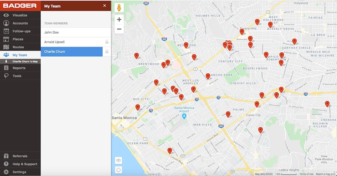
Teamwork is a huge part of many people’s sales process. One of Badger Maps most popular features, “My Team,” allows you to link different Badger Maps accounts together into teams.
Both sales reps and managers can benefit from using My Team. Team View allows reps to see their account status, view their territories, and access team activity reports.
Managers can use Manager View to access all team member check-ins, territories, routes, and activity reports. Having this information allows managers to get an accurate view of what’s going on in the field and catch problems before they arise. Managers can also directly edit their team members’ territories and routes.
Badger Maps knows the importance of collaboration, so the feature is customizable for field sales teams of any size.
The best part? Badger Maps has a free team pilot program so that you can see how it works for your entire team.

Best Alternative to Streets and Trips — Advanced reporting
With Badger Maps, it's easy to know what goes on in the field. Every time you make a check-in, Badger Maps saves the information in a check-in report. The report includes account information, a timestamp, and the notes of that visit.
Every Friday, check-in reports are automatically sent to your inbox. Users can also export their report at any time, allowing them to view their progress without manually going through each account.
For reps, these reports provide the ability to track performance and keep notes of the work they've completed over a given period of time
For managers, reports help identify sales curves and trends and build an incentive program for reps.
Report generation was nonexistent in Microsoft Streets and Trips. This resulted in hours spent tending to tiresome administrative duties. Badger Maps automatically generates reports each week, saving you time and helping you be more productive than ever.
More Alternatives To Microsoft Streets and Trips
With so many mapping tools available, it makes sense to explore your options to be certain you choose the right one for your needs. Here are a few additional mapping tools that are worth looking into:
Mapquest
- Price: Free
- Best for: Road Trips, Simple Routing
Launched in 1996, MapQuest was the first commercial web mapping service. This reliable software is used to create simple routes, locate businesses, and book hotels.
MapQuest limits how many stops you can add to optimized routes, which makes it better suited for road trips and other simple routes.
Roadtrippers
- Price: Free or Plus for $35.99/year
- Best for: Road Trips, Sightseeing
Roadtrippers is a web-based software application and mobile app designed to help travelers plan epic road trips. With Roadtrippers you can plan trips, discover unique destinations along your route, read reviews of points of interests, and calculate gas cost.
This app is perfect for adventurers looking to enjoy the journey and not just the destination.
Mapline
- Price: Contact for pricing information
- Best for: Sales/Data Visualization
Mapline is a web-based mapping tool for territory and data visualization. By importing your data to Mapline, you can get a customized view of your customer base and use the analytical tools to plan your next steps. Additionally, you can use Mapline to create territories and build routes.
Xactly AlignStar
- Price: Contact for pricing information
- Best for: Sales Territory Management
Xactly AlignStar is a territory management tool that allows you to visualize and adjust territories with no hassle. Through data analysis, AlignStar enables you to rebalance territories based on your parameters, and discover new sales opportunities for your reps.
AlignStar is geared towards sales managers and does not have features, such a route planning, that sales reps may be looking for.
Try out the Best Microsoft Streets and Trips Alternative
For outside salespeople, Badger Maps is the best Microsoft Streets and Trips alternative. Offering many of the same tools that came with Microsoft Streets and Trips, field salespeople throughout the industry have made the switch to Badger Maps — and are loving the updated features.
Support and onboarding for new users is just a call or email away. So make the change to Badger Maps today, and empower yourself with the #1 route planner for field sales on the market. Start your free trial today!
Co-authors: Christina Carpio and Mitch Paglia
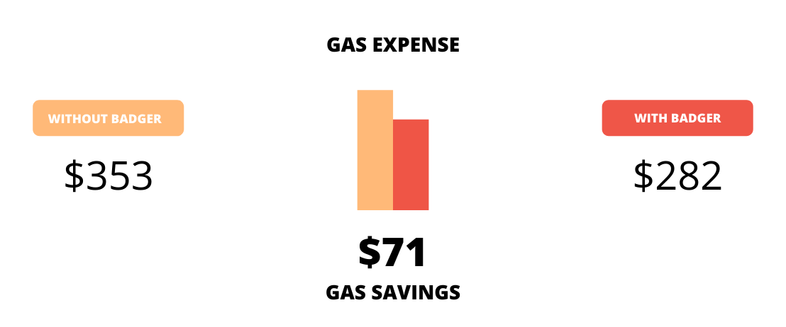
BADGER PAYS FOR ITSELF WITH GAS SAVINGS
Sales Reps using Badger sell at least 22% more and drive 20% fewer miles.
See the potential return on investment you can get by using Badger Maps with your field sales team.
The Best App for Field Sales People
Learn how you can maximize your sales routes & sell more with Badger Maps
Related
Solutions
Sales Manager Sales Reps Sales Trainers Features Customer Stories Pricing Team Pilots Field ServiceResources
Blog Careers Product Updates ROI with Badger Sales Podcast Streets and Trips Alternative Badger Sales University Watch a Demo VideoLooking for our logo?
Grab a Zip packed with our logo in PNG and EPS formats.
Get Started now with a free trial of Badger Maps, no credit card required!
free trial


